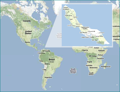
The island lies about 60 km from the mainland (north of Venezuela and north-east of Colombia).
West of Curaçao is the island of Aruba, which belonged to 1986, also part of the Netherlands Antilles, east of the island of Bonaire.
Along with that Curaçao is geographically within the Netherlands Antilles to the Windward Islands, while the other three political belonging to these islands (Saba, Sint Eustatius and Sint Maarten) is one of the Windward Islands.
South-east Klein Curaçao, a favorite for divers uninhabited island where the lighthouse is only one.
The islands of Aruba, Bonaire and Curacao are called together on the basis of their initial letters as ABC islands.
Curaçao is located in the direct
sphere of influence of the northeast
trade winds. Since the island is too
shallow slope for rain, bring the air
mass is relatively little rain to the
island and as the rainfall in Curaçao
not be regular, there are no permanent
rivers on the island. It is a semi-arid
climate with a daytime average annual
rainfall of 550 mm and an annual average
of almost 28 ° C. The annual rainfall
with ranges between 200 and 1200 mm,
however subject to very strong
fluctuations.
Highest elevation
is the Sint-Christoffel Mountain.
Caribbean holidays in Curaçao
Curaçao - guaranteed fantastic holidays
Geography and climate in Curaçao
The population and languages on Curaçao
![]() PERSONAL POINT OF CONTACT
PERSONAL POINT OF CONTACT
![]() ALL YEAR TRANSPARENT PRICES
ALL YEAR TRANSPARENT PRICES
![]() RELIABLE PREDICTABLE TRAVEL COSTS
RELIABLE PREDICTABLE TRAVEL COSTS
![]() TIMELESS BOOKING PROCESSES
TIMELESS BOOKING PROCESSES
![]() FAST CHECK-IN / -OUTS
FAST CHECK-IN / -OUTS


